


")
The hikes around Analamanga organized by the Regional Office Tourism Analamanga (FORT) continue and are not alike. This 22 July 2017, new route, new landscape, hikers will gather you Antananinarenina, starting point for a walk to Iharanandriana, south of Antananarivo.
La colline d'Iharanandriana
It is located 35km south of the capital and is within the boundary of the Analamanga region and the region Vakianakaratra. Recognizable by the most capped peak south huge blocks of granite, it is also known as the headset name Behenjy, town famous for foie gras production.
On more 7,5 kilometers, this circuit will last about two hours and a half. No need to be an experienced hiker to do, it is only necessary to be a good walker. The walk starts at the small village of Tsinjony, and continues with a crossing of the river Andromba. The climb to the summit, at 1690m is shaded by a forest of Tapia, xerophile and endemic plant of Central Highlands of Madagascar.
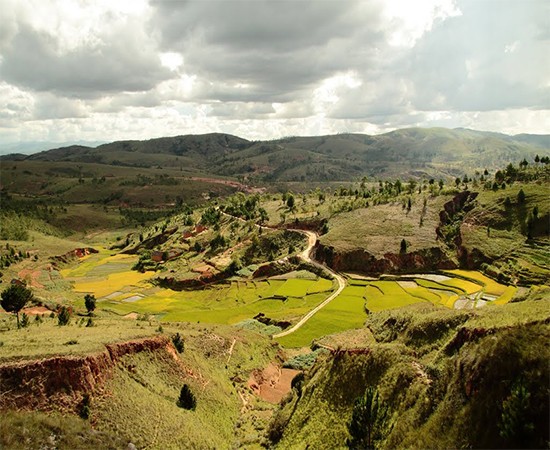
After regaining breath, a small road follows the entire ridge and offers a beautiful view of the countryside. The walk ends with a descent near the factory Mado, producer of mineral water from the mountains of Iharanandriana, to finally join the national 7.
This walk is an opportunity to enjoy the panoramic view, rural landscape, the tapia forest and the history of the region.
Inscription au Kiosque d'Information de l'Horta au Jardin d'Antaninarenina
Such: +261 34 20 270 51
Mail: accueil-antaninarenina@ortana.mg

Comment (0)