


")
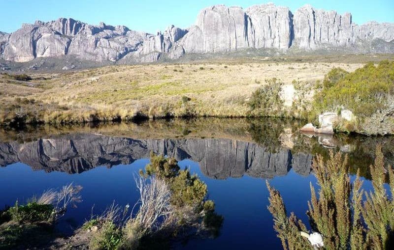
A vast plain watered a clear lake surrounded by huge rocks, this is the scenery of a part of the National Park Andohahela. Another part is forested. That's why this natural reserve is included by UNESCO in the list of "Rainforest in the Atsinanana" as well as the Marojejy National Park. That is to say, it is among the rainforests of Madagascar survivors. Yes, that's right, if we may say so. The rain forest of Andohahela is rescued : she was able to withstand the successive natural disasters that Madagascar could never be saved because of its geographical position.
This protected area is vast 760 km². It is located 40 km northeast of Fort Dauphin. Also called Tolagnaro, Fort Dauphin is the capital of the region Anosy, in the Southeast of the country. It is the largest town near the park.
Run by the Association of National Parks Madagascar, Nature Reserve has National Park status category II IUCN (International Union for Conservation of Nature). what status, it has since the year 1998.
To get there by car, you follow the N7 leads to Tulear. You veer to KP 593 located at Ihosy. You begin the RN13. From there, Various tours are offered : Tsimelahy with its famous palm triad, Mangatsiaka with its endemic fauna, le circuit cyclable reliant Tsimelahy et Cold, Malio and typical forest in southern Madagascar, Malio Talakifeno who share Malio and ends at the camp site, Ihazofotsy which is a three-stage system, and finally, Manangotry with lively trails lemurs fulvus collaris kind of eulemur.
So, you are on the RN13. To join Tsimelahy, for example, you follow the road to Ankariera. Pour aller à Cold, you follow the road leading to Ranomainty.

Comment (0)